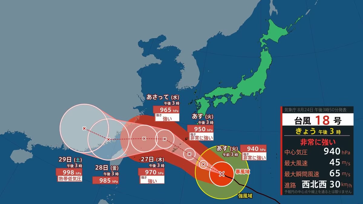
2026年8月25日、非常に強い台風18号が日本の南を西寄りに進んでいます。気象庁によると、25日から27日ごろにかけて沖縄や南西諸島に接近する見込みです。
On 25 August 2026, very strong Typhoon 18 is moving westward over the seas south of Japan. According to the Japan Meteorological Agency, it is expected to approach Okinawa and the Nansei Islands from the 25th to around the 27th.
この台風により、暴風や高波、大雨が予想されています。特に沖縄本島付近では猛烈な風のおそれがあり、厳重な警戒が必要です。
This typhoon is expected to bring strong winds, high waves and heavy rain. Especially near the main island of Okinawa, there is a risk of extremely strong winds, requiring strict caution.
気象庁は、土砂災害や低い土地の浸水、河川の増水にも注意するよう呼びかけています。台風の速度が遅くなる可能性があり、影響が長引くおそれがあります。
The Meteorological Agency is calling for caution against landslides, flooding in low-lying areas and rising river levels. The typhoon’s speed may slow, potentially prolonging its impact.
住民は早めに避難の準備をし、窓や戸をしっかり閉めてください。また、屋外での活動は避け、最新の情報を確認することが大切です。
Residents should prepare for early evacuation and securely close windows and doors. It is also important to avoid outdoor activities and check the latest information.
沖縄ではすでに飛行機の欠航や船の運休が始まっています。観光客や地元の人は、台風の進路情報をこまめに確認し、安全を最優先にしてください。
In Okinawa, flight cancellations and ferry suspensions have already begun. Tourists and local residents should frequently check the typhoon’s path information and put safety first.